Cristina and I have been a fan of “making the connection” ever since I first learned of the concept whilst reading a Tom Cahill travel story about “spelunking”, the sport of cave exploration. In caves, the challenge is to find a way out of the cave that is different than your way in, so that you have “making the connection” through the cave—usually this follows the current/past path of water through which formed the cave structure. We learned to apply the spirit of “making the connection” to any kind to many sorts of adventurous—car trips, walking and hiking outings, multi-country or city vacations, etc. The goal is to always return via a different route, the better to see new places/things along the way, and not return via known path. This has never gone wrong on us, although a few times we did find ourselves on difficult roads, longer than desired outings, and a few times, completely lost and near despair—but nothing serious that wasn’t outweighed by the excitement of exploration and adventure.
However, last weekend things went horribly wrong.
My friend from China Li has been visiting me in seattle, and was desirous of some outdoors time and we agreed on the Olympic Peninsula. A friend recommended the Storm Ridge Trail at Crescent Lake, about 3 hrs drive from Seattle proper via Puget Sound Ferry crossing. We left the house at 5:45 am and arrived at trailhead just ahead of 9am. The ranger at the trail head was not yet open for business, but we caught a few words with him as he was raising the flag on the flagpost, and learned that the trail was “straight up ahead”, that it was “very strenuous/challenging”, and that it should take no more than “3 hours” roundtrip. A “3 hour tour”, as Gilligan’s Island theme song says…

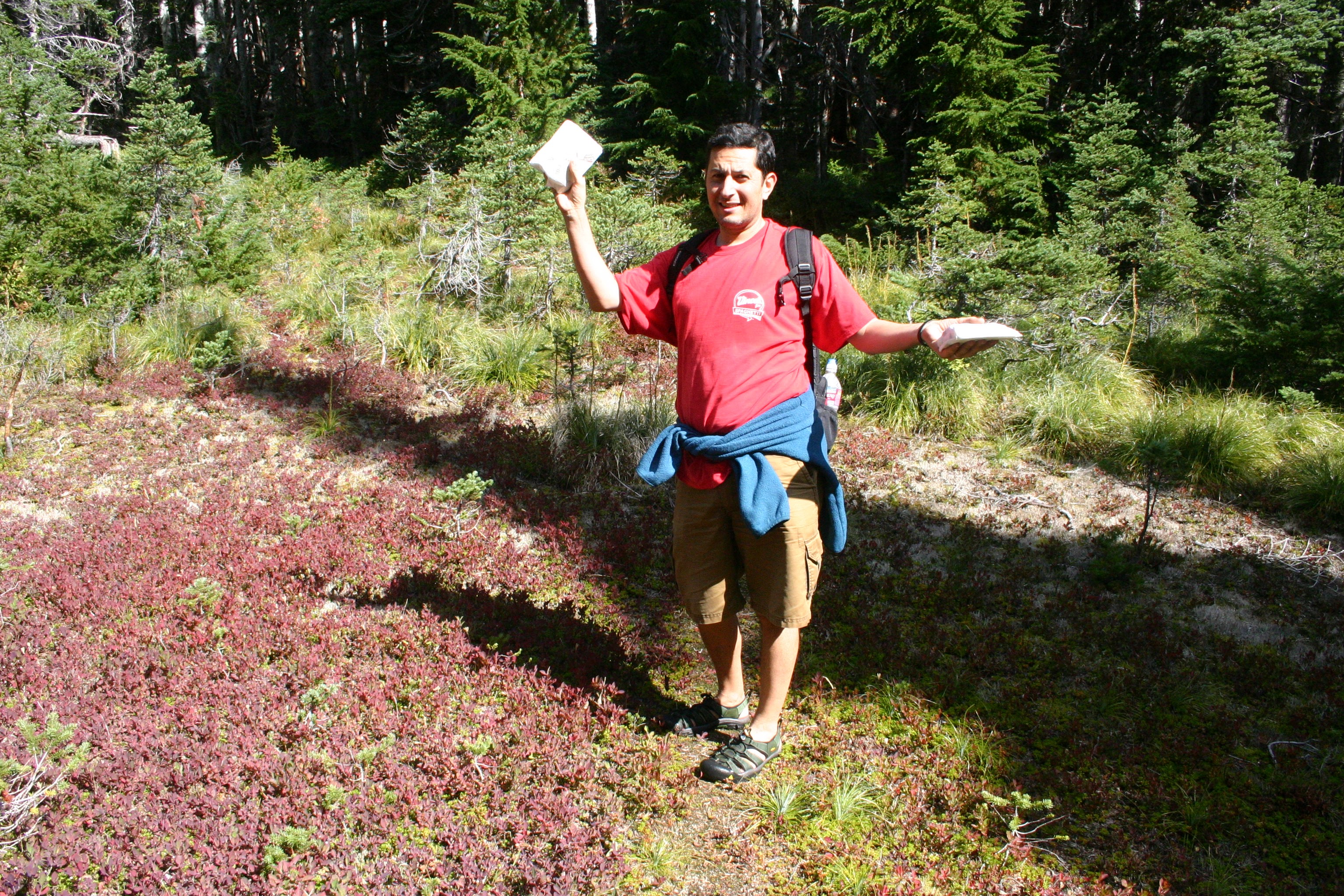
Given the relatively short time horizon, we took with us16 ounces of water each, a sandwich, some dried apricots, and were lightly clothed (i in shorts and sandals + tshirt. This was mistake number 1… new motto in life will forever be “always take 3x the water you think you need”.
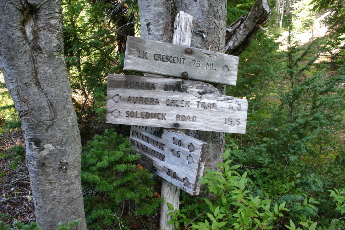
We started hiking and were instantly in a happy place—gorgeous day, tall verdant trees and lush ferns all around us, a happy little stream/creek running through the valley that we started to slowly ascend. Eventually the trail started to get steeper, then VERY steep, and we spent what seemed like hours hiking straight up a never ending series of switchback turns. After what seemed like 3 hours i was beginning to worry that we might be on the wrong trail… lo and behold, it had indeed been 3 hours! and we WERE on the wrong trail! We finally crested the climb and found ourselves at an intersection of our trail with another well signed/indicated park trail. At this point we looked on the map we had picked up at trailhead (note to self—look at map before starting, not only once realizing you are lost) and found that we had hiked 7.5 miles already (making our current hike a 6 hour project even if we turned back right now), this as we finished the last drops of water we had with us.
So we had a decision to make… turn around immediately and return to the car by trail we just climbed, or… “make the connection”—a path to our left clearly indicated by trailhead signs indicated it was 5 miles down the trail, where another trail would meet and from there 2 miles to the road. in other words—7 miles back to the road (where we could hitchhike to the car) by a NEW path, with likely better views of the valley and lake than our hike to date had offered, or a retreat in defeat by our first route. Neither Allan nor I hesitated for a second—we wanted to make the connection, and we headed off on the Aurora Ridge Trail for what would be a fun, if thirsty, second half of our day. Even now thinking back on that decision, i don’t think we were making a mistake given the information we had available to us. In the future, the lack of water will be something that would sway me more, but at that time, i felt that i was going to be thirsty one way or another, so might as well see some new sights along the way!
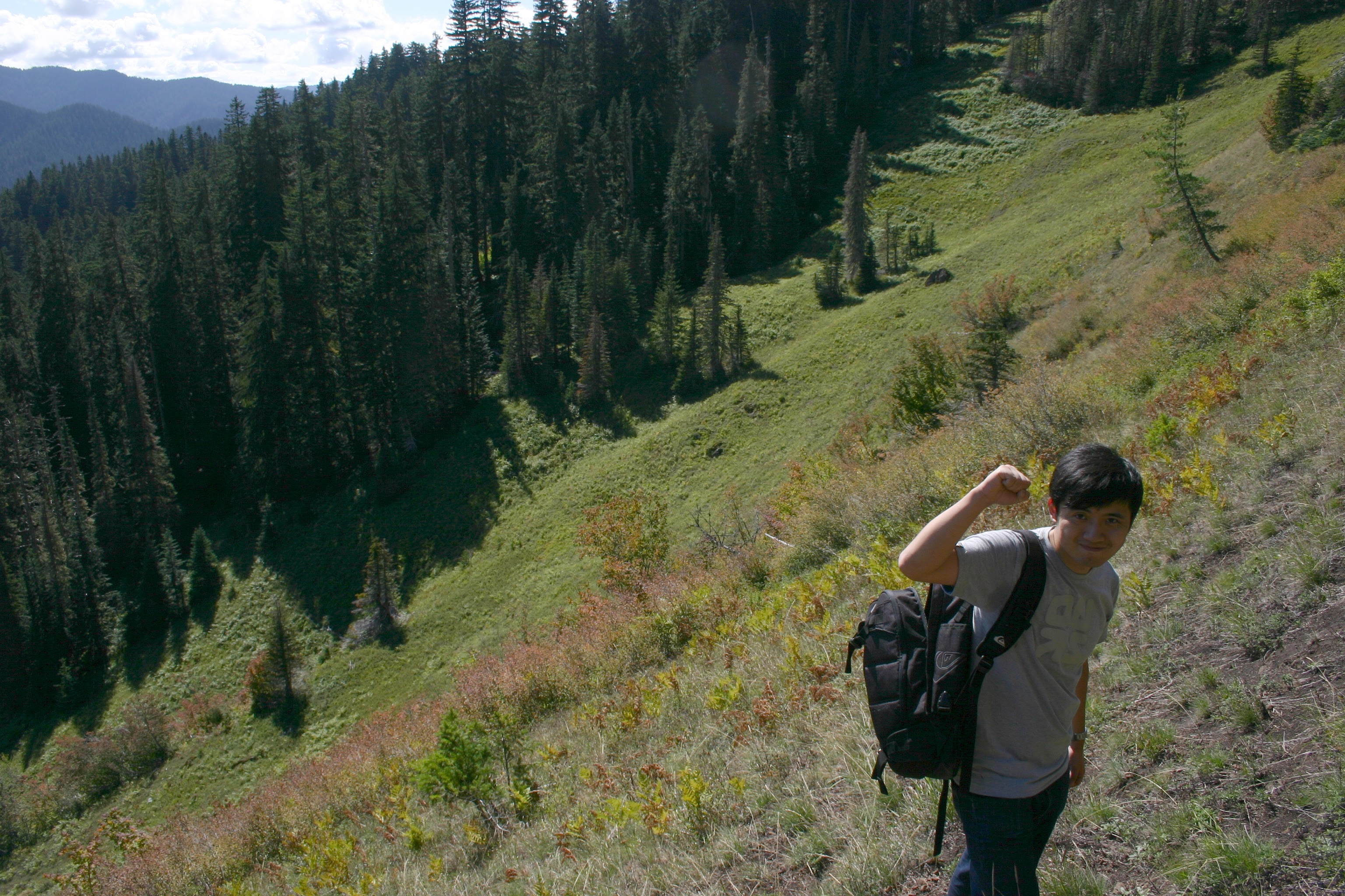
So… 2 hours later (along a beautiful trail i might add), we enter into a meadow and the trail starts to fade out into bushes and tall grass. This had sort of happened a few times earlier, so we weren’t immediately alarmed, but as the minutes past and we searched high and low, including going forward on promising leads and then retreating to last known part of the trail several times, we increasingly had a feeling of “holy cow, this trail doesn’t continue”. We were now 12 miles from our car, with a good uphill climb at our backs in order to get to the original trail, extremely tired (cramping in legs was very intense, especially during any increase of elevation/slope), and did i mention—had no water? What to do?
Frankly, for the next 2 hours I didn’t think once of going back—it was simply to far to try 12 mile hike, when we were only 2.5 miles from the road and safety—if we could just find the trail! So this is when we made our first real mistake—we went off the trail (NEVER LEAVE THE TRAIL) and started hiking along the ridge and through the forest, whilst visually trying to decipher the topology around us and mapping it back to our extremely low resolution/not topo-map map. Thank god neither of us broke a leg or otherwise got into trouble at this point, we were stomping around on very steep slopes, over and under big fallen trees, and fortunately did not come across rattlesnakes or bears/etc. However, now it is nearing 4pm, we are really lost, and the prospect of spending the night in the woods is starting to loom (with no water!)
So we make our way back to the trail, in the middle of a meadow, in the middle of a lovely forest… just 2.5 miles from the road, perhaps just 500 meters from the trail to that road, and have to settle on turning back (not making the connection!) and retracing our steps back up and then down what will total 12.5 miles.
Despite the pain in our legs, the sense of impending doom, and thirst!!!!!! Allan and I both had a remarkably serene outlook… we were having fun the entire time. I pushed my body farther on this hike than I did during the marathon in tokyo earlier this year, and there was the prospect of possible injury or worse, but i never lost sight off the beauty of nature, the spiritual stillness surrounding us. This was a fun day.
That said—in the meadow, looking up and down the ridge, off the trail where we shouldn’t have been, i couldn’t help but ask myself “are you frickin kidding me… how is this happening to us?” It was “Touching the Void”, “Into Thin Air”, and “Man vrs Wild” all wrapped up in one crazy brain rush. My wife and kids are in Chile, so far away… and I’m just 2 miles from the road—but i’m LOST without water, in real danger.
Oh shit.
Anyways, while there are many more details that are curious and fun to narrate in person, for the blog i’ll share the big finale—we made it to the ridge by 6pm, giving us 2 hrs to return down a 3hr section (before certain nightfall/darkness). We drank some running water we found (giardia and other diarrhea producing diseases likely found in the water source, be damned!) and tromped down the path to the creek in the valley, where we were hosted to total and utter darkness, the kind where you can’t see ANYTHING in front of you, let alone the path which runs along the ravine, full of precipitous rocks and other obstacles
that would be painful to experience after a fall.
This is where the iPhone came in—my phone had been without a signal all day, and useless as a phone, GPS/map, email, or anything else… but as a flashlight, however dim the screen would otherwise be considered, it was a godsend. Allan held on to my backpack and i guided us forward like two blind/lost bozos, for what was at least 2 miles. When we finally saw the headlights of cars on the road ahead we knew we were going to get home that night.
We were on the trail for 12 hrs. 25 miles. 5,000 + feet up (and then down). Wow.
To repeat, lessons learned:
(1) take more water than you could ever drink
(2) for good measure, always take water purifying tablets (along with a canteen or plastic bottle that could be used for that purpose)
(3) don’t always trust the forest/park service signs… we were on marked paths that turned out to be not very well maintained—we put too much faith in the park service
(4) making the connection, need not always be, the #1 priority!

